The curiosity
Wild clay is everywhere and almost nobody knows where. The information exists: the USDA has mapped the soil under nearly every acre of the country, down to the layers and their colors. It is published for farmers and engineers, in a form no potter would ever open. I wanted to stand in a field, tap my phone, and know what was under my feet.
What it does
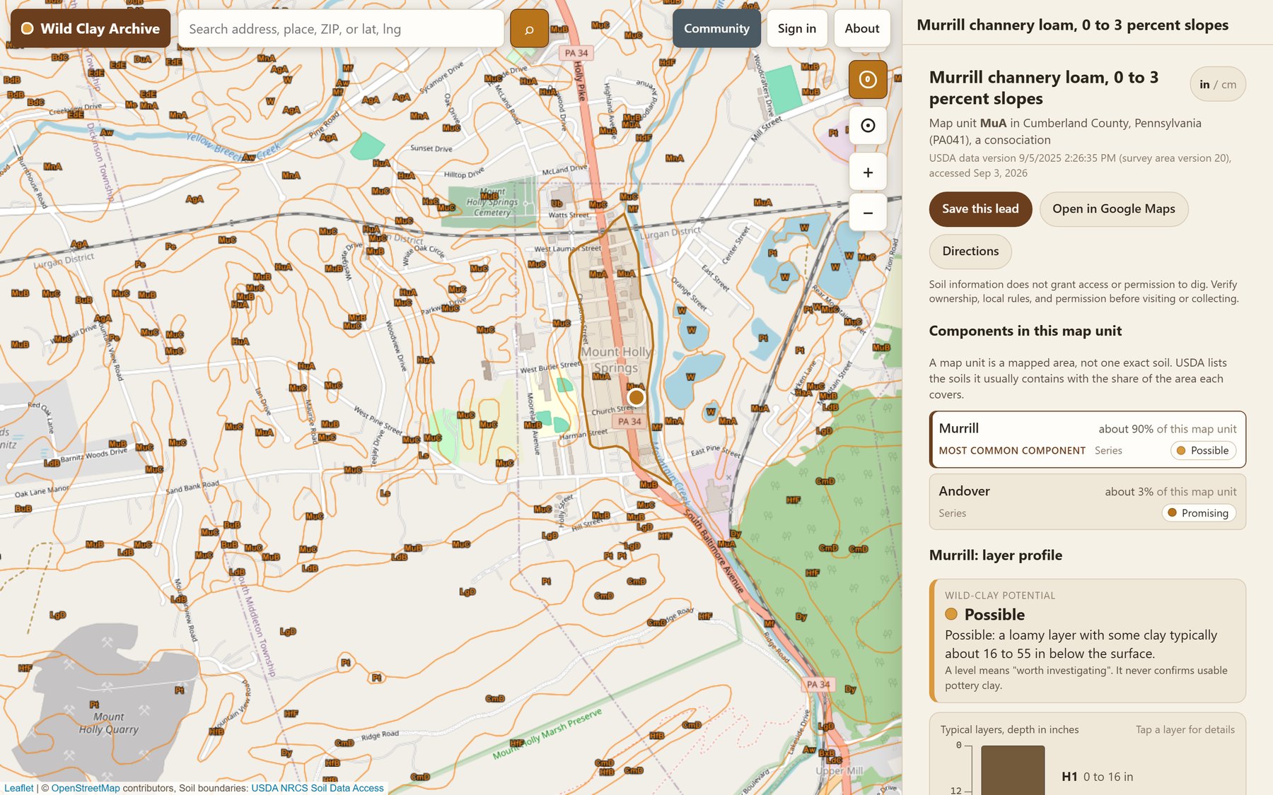
Tap the map, search a place, or use your location. The Archive names the soil unit beneath the point, lists the soils it usually contains and how much of the area each covers, draws the layers down through the profile in their reported colors, and says in plain words whether it is worth investigating. Anyone can explore. An account is only for saving a lead or sharing one.
The system
Underneath is public survey data, soil boundaries, series descriptions, and horizon records, read live for the point you chose, and a set of rules that turn a soil profile into a potential level with its reasons. A level means worth investigating; it never confirms usable clay, and it never grants permission to dig. Shared leads are approximate by default, snapped to a grid about a kilometer across, and exact only by deliberate choice. It runs on free tiers and costs nothing to keep alive.
Cause and effect
The map above is one real lookup. The input was a point outside Mount Holly Springs, Pennsylvania, the town whose white clay is the subject of the first hunt log. The output: Murrill channery loam, 0 to 3 percent slopes. Murrill is about ninety percent of the unit. A loamy layer with some clay, typically 16 to 55 inches down. Potential, possible.
What changed
“Is there clay here” went from a research project to a tap. The first real field test was a spot I already knew, and the app read the ground the way I did. Every lead saved in the field becomes a record, and every record someone chooses to share becomes part of an archive that gets more useful the more people dig.
Experience it
Open the map. The hunts behind it are written up in The Wild Clay Hunt.